
Recent satellite and microwave imagery show Typhoon Saudel (17W) has undergone rapid intensification to around 110 knots, with a redeveloping eye and vortical hot towers, but an imminent eyewall replacement cycle is expected to limit further strengthening. Official guidance from JTWC, JMA, and ensemble models projects a flat intensity trend over the next 24 hours followed by gradual weakening from increasing vertical shear, cooler sea-surface temperatures, and reduced ocean heat content as the system tracks northwest toward the Ryukyu Islands and eventual landfall in China. These environmental factors, combined with historical analogs of similar late-August western Pacific systems that rarely sustain violent-typhoon thresholds (105+ knots) for long, underpin trader consensus favoring a very strong typhoon peak while assigning low odds to higher categories. Updated model runs and NHC/JTWC briefings in the coming days will refine the peak wind threshold.
Eksperimental na AI-generated summary na nire-reference ang Polymarket data. Hindi ito trading advice at wala itong papel sa kung paano nire-resolve ang market na ito. · Na-updateHow strong will Tropical Storm Saudel get?
How strong will Tropical Storm Saudel get?
Very Strong Typhoon 86%
Violent Typhoon 14%
Typhoon 1.5%
Tropical Storm <1%
Tropical Storm
<1%
Severe Tropical Storm
<1%
Typhoon
2%
Very Strong Typhoon
86%
Violent Typhoon
14%
Very Strong Typhoon 86%
Violent Typhoon 14%
Typhoon 1.5%
Tropical Storm <1%
Tropical Storm
<1%
Severe Tropical Storm
<1%
Typhoon
2%
Very Strong Typhoon
86%
Violent Typhoon
14%
Resolution is by wind speed: take the highest 10-minute maximum sustained wind speed JMA reports for Saudel in any single advisory during its lifetime, and the market for the one category whose range contains that value resolves "Yes." The categories are defined solely by these inclusive knot ranges: Tropical Storm (34-47 kt), Severe Tropical Storm (48-63 kt), Typhoon (64-84 kt), Very Strong Typhoon (85-104 kt), and Violent Typhoon (105 kt or higher). These names label the wind-speed ranges; JMA's own strength wording need not appear in an advisory for a category to resolve. The peak must occur on or before the deadline, though the confirming JMA data may be published later.
Saudel is already a tropical storm, so its peak is at least "Tropical Storm". The wind speed in JMA's issued advisories is final and is not changed by any later reclassification or post-season best-track reanalysis. Where JMA advisory data is disputed, the values recorded by the Digital Typhoon database (National Institute of Informatics, Japan) for Typhoon 202618 (SAUDEL) are treated as conclusive evidence of what JMA reported. JMA is the primary and default resolution source.
Binuksan ang Market: Aug 20, 2026, 11:11 AM ET
Resolution Source
https://www.jma.go.jp/bosai/map.html#contents=typhoon&lang=enResolver
0x69c47De9D...Resolution is by wind speed: take the highest 10-minute maximum sustained wind speed JMA reports for Saudel in any single advisory during its lifetime, and the market for the one category whose range contains that value resolves "Yes." The categories are defined solely by these inclusive knot ranges: Tropical Storm (34-47 kt), Severe Tropical Storm (48-63 kt), Typhoon (64-84 kt), Very Strong Typhoon (85-104 kt), and Violent Typhoon (105 kt or higher). These names label the wind-speed ranges; JMA's own strength wording need not appear in an advisory for a category to resolve. The peak must occur on or before the deadline, though the confirming JMA data may be published later.
Saudel is already a tropical storm, so its peak is at least "Tropical Storm". The wind speed in JMA's issued advisories is final and is not changed by any later reclassification or post-season best-track reanalysis. Where JMA advisory data is disputed, the values recorded by the Digital Typhoon database (National Institute of Informatics, Japan) for Typhoon 202618 (SAUDEL) are treated as conclusive evidence of what JMA reported. JMA is the primary and default resolution source.
Resolution Source
https://www.jma.go.jp/bosai/map.html#contents=typhoon&lang=enResolver
0x69c47De9D...Recent satellite and microwave imagery show Typhoon Saudel (17W) has undergone rapid intensification to around 110 knots, with a redeveloping eye and vortical hot towers, but an imminent eyewall replacement cycle is expected to limit further strengthening. Official guidance from JTWC, JMA, and ensemble models projects a flat intensity trend over the next 24 hours followed by gradual weakening from increasing vertical shear, cooler sea-surface temperatures, and reduced ocean heat content as the system tracks northwest toward the Ryukyu Islands and eventual landfall in China. These environmental factors, combined with historical analogs of similar late-August western Pacific systems that rarely sustain violent-typhoon thresholds (105+ knots) for long, underpin trader consensus favoring a very strong typhoon peak while assigning low odds to higher categories. Updated model runs and NHC/JTWC briefings in the coming days will refine the peak wind threshold.
Eksperimental na AI-generated summary na nire-reference ang Polymarket data. Hindi ito trading advice at wala itong papel sa kung paano nire-resolve ang market na ito. · Na-update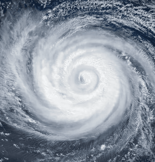

Mag-ingat sa mga external link.
Mag-ingat sa mga external link.
Mga Madalas na Tanong