
Recent JMA and JTWC guidance shows Tropical Storm Saudel undergoing rapid intensification in the western Pacific due to sea surface temperatures above 29°C, low vertical wind shear, and strong upper-level divergence. These conditions support peak sustained winds near 90 knots and central pressure around 940 hPa by 23 August, aligning with very strong typhoon thresholds on the JMA scale. Model consensus remains tight on this outcome, though an eyewall replacement cycle could briefly limit further gains, keeping violent typhoon odds modest. Traders are weighting the favorable environment and historical analogs for similar systems in the Philippine Sea during late August. Updated intensity forecasts and satellite observations over the next 24–48 hours will refine these probabilities.
Riepilogo sperimentale generato dall'AI con riferimento ai dati di Polymarket. Questo non è un consiglio di trading e non ha alcun ruolo nella risoluzione di questo mercato. · AggiornatoQuanto sarà forte la tempesta tropicale Saudel?
Quanto sarà forte la tempesta tropicale Saudel?
Tifone molto forte 86%
Tifone Violento 13%
Tifone 1.7%
Tempesta tropicale <1%
Tempesta tropicale
<1%
Tempesta Tropicale Severa
<1%
Tifone
2%
Tifone molto forte
86%
Tifone Violento
13%
Tifone molto forte 86%
Tifone Violento 13%
Tifone 1.7%
Tempesta tropicale <1%
Tempesta tropicale
<1%
Tempesta Tropicale Severa
<1%
Tifone
2%
Tifone molto forte
86%
Tifone Violento
13%
Resolution is by wind speed: take the highest 10-minute maximum sustained wind speed JMA reports for Saudel in any single advisory during its lifetime, and the market for the one category whose range contains that value resolves "Yes." The categories are defined solely by these inclusive knot ranges: Tropical Storm (34-47 kt), Severe Tropical Storm (48-63 kt), Typhoon (64-84 kt), Very Strong Typhoon (85-104 kt), and Violent Typhoon (105 kt or higher). These names label the wind-speed ranges; JMA's own strength wording need not appear in an advisory for a category to resolve. The peak must occur on or before the deadline, though the confirming JMA data may be published later.
Saudel is already a tropical storm, so its peak is at least "Tropical Storm". The wind speed in JMA's issued advisories is final and is not changed by any later reclassification or post-season best-track reanalysis. Where JMA advisory data is disputed, the values recorded by the Digital Typhoon database (National Institute of Informatics, Japan) for Typhoon 202618 (SAUDEL) are treated as conclusive evidence of what JMA reported. JMA is the primary and default resolution source.
Mercato aperto: Aug 20, 2026, 11:11 AM ET
Fonte di risoluzione
https://www.jma.go.jp/bosai/map.html#contents=typhoon&lang=enResolver
0x69c47De9D...Resolution is by wind speed: take the highest 10-minute maximum sustained wind speed JMA reports for Saudel in any single advisory during its lifetime, and the market for the one category whose range contains that value resolves "Yes." The categories are defined solely by these inclusive knot ranges: Tropical Storm (34-47 kt), Severe Tropical Storm (48-63 kt), Typhoon (64-84 kt), Very Strong Typhoon (85-104 kt), and Violent Typhoon (105 kt or higher). These names label the wind-speed ranges; JMA's own strength wording need not appear in an advisory for a category to resolve. The peak must occur on or before the deadline, though the confirming JMA data may be published later.
Saudel is already a tropical storm, so its peak is at least "Tropical Storm". The wind speed in JMA's issued advisories is final and is not changed by any later reclassification or post-season best-track reanalysis. Where JMA advisory data is disputed, the values recorded by the Digital Typhoon database (National Institute of Informatics, Japan) for Typhoon 202618 (SAUDEL) are treated as conclusive evidence of what JMA reported. JMA is the primary and default resolution source.
Fonte di risoluzione
https://www.jma.go.jp/bosai/map.html#contents=typhoon&lang=enResolver
0x69c47De9D...Recent JMA and JTWC guidance shows Tropical Storm Saudel undergoing rapid intensification in the western Pacific due to sea surface temperatures above 29°C, low vertical wind shear, and strong upper-level divergence. These conditions support peak sustained winds near 90 knots and central pressure around 940 hPa by 23 August, aligning with very strong typhoon thresholds on the JMA scale. Model consensus remains tight on this outcome, though an eyewall replacement cycle could briefly limit further gains, keeping violent typhoon odds modest. Traders are weighting the favorable environment and historical analogs for similar systems in the Philippine Sea during late August. Updated intensity forecasts and satellite observations over the next 24–48 hours will refine these probabilities.
Riepilogo sperimentale generato dall'AI con riferimento ai dati di Polymarket. Questo non è un consiglio di trading e non ha alcun ruolo nella risoluzione di questo mercato. · Aggiornato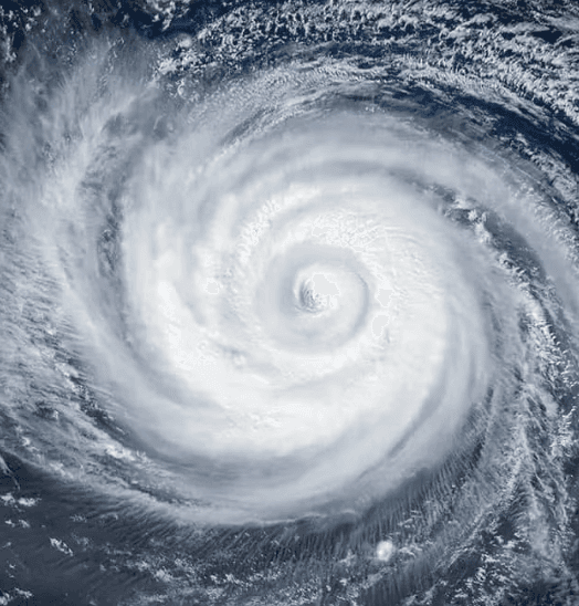

Fai attenzione ai link esterni.
Fai attenzione ai link esterni.
Domande frequenti