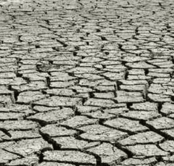
**Persistent high-pressure systems and late-summer heat have driven rapid drought intensification across the south-central and north-central United States in late August 2026, expanding areas of D3 (extreme) and D4 (exceptional) drought on the U.S. Drought Monitor while monsoonal activity has offered limited relief in parts of the Southwest.** As of the most recent maps (data valid around August 25), D4 conditions remain concentrated in a handful of Western and High Plains states—such as portions of Oregon, Idaho, New Mexico, and Nebraska—with notable expansions tied to soil-moisture deficits, groundwater declines, and vegetation stress. Trader sentiment reflects genuine uncertainty in the final count for the September 1 week because short-term precipitation and evapotranspiration rates can push marginal D3 areas into D4 across additional states in the Upper Midwest or Southern Plains, or allow slight improvements if scattered rains materialize. A developing strong El Niño adds further complexity: it favors above-normal precipitation in the Southwest (potentially limiting new D4 formation) but can suppress rainfall in the Northwest and alter steering patterns elsewhere, with model consensus still diverging on the exact timing and extent of impacts. Historical baselines show D4 is typically rare outside core arid regions, making the current multi-region footprint sensitive to the next 1–2 weeks of conditions and the precise thresholds used in the weekly U.S. Drought Monitor assessment.
Resumo experimental gerado por IA com dados do Polymarket. Isto não é aconselhamento de trading e não tem qualquer papel na resolução deste mercado. · AtualizadoQuantos estados estarão em D4 (Seca Excepcional) — semana de 1º de setembro de 2026?
Quantos estados estarão em D4 (Seca Excepcional) — semana de 1º de setembro de 2026?
7 a 9 estados 38%
1-2 estados 38%
3-4 estados 38%
5-6 estados 38%
0 estados
2%
1-2 estados
38%
3-4 estados
38%
5-6 estados
38%
7 a 9 estados
38%
10 ou mais estados
47%
7 a 9 estados 38%
1-2 estados 38%
3-4 estados 38%
5-6 estados 38%
0 estados
2%
1-2 estados
38%
3-4 estados
38%
5-6 estados
38%
7 a 9 estados
38%
10 ou mais estados
47%
Brackets: 0 / 1-2 / 3-4 / 5-6 / 7-9 / 10+. Exactly one bracket resolves "Yes".
The count ranges over all 48 coterminous states — the 48 states excluding Alaska and Hawaii. The District of Columbia and U.S. territories are not considered.
Each USDM release covers the seven-day period ending Tuesday at 8:00 AM ET and is published the following Thursday.
Resolution is based on the first published US Drought Monitor release for the listed week. Subsequent revisions will not be considered; the first published release is final.
The resolution source for this market is the US Drought Monitor at droughtmonitor.unl.edu.
Mercado Aberto: Aug 27, 2026, 9:00 AM ET
Fonte de resolução
https://droughtmonitor.unl.edu/DmData/DataTables.aspxResolver
0x69c47De9D...Brackets: 0 / 1-2 / 3-4 / 5-6 / 7-9 / 10+. Exactly one bracket resolves "Yes".
The count ranges over all 48 coterminous states — the 48 states excluding Alaska and Hawaii. The District of Columbia and U.S. territories are not considered.
Each USDM release covers the seven-day period ending Tuesday at 8:00 AM ET and is published the following Thursday.
Resolution is based on the first published US Drought Monitor release for the listed week. Subsequent revisions will not be considered; the first published release is final.
The resolution source for this market is the US Drought Monitor at droughtmonitor.unl.edu.
Fonte de resolução
https://droughtmonitor.unl.edu/DmData/DataTables.aspxResolver
0x69c47De9D...**Persistent high-pressure systems and late-summer heat have driven rapid drought intensification across the south-central and north-central United States in late August 2026, expanding areas of D3 (extreme) and D4 (exceptional) drought on the U.S. Drought Monitor while monsoonal activity has offered limited relief in parts of the Southwest.** As of the most recent maps (data valid around August 25), D4 conditions remain concentrated in a handful of Western and High Plains states—such as portions of Oregon, Idaho, New Mexico, and Nebraska—with notable expansions tied to soil-moisture deficits, groundwater declines, and vegetation stress. Trader sentiment reflects genuine uncertainty in the final count for the September 1 week because short-term precipitation and evapotranspiration rates can push marginal D3 areas into D4 across additional states in the Upper Midwest or Southern Plains, or allow slight improvements if scattered rains materialize. A developing strong El Niño adds further complexity: it favors above-normal precipitation in the Southwest (potentially limiting new D4 formation) but can suppress rainfall in the Northwest and alter steering patterns elsewhere, with model consensus still diverging on the exact timing and extent of impacts. Historical baselines show D4 is typically rare outside core arid regions, making the current multi-region footprint sensitive to the next 1–2 weeks of conditions and the precise thresholds used in the weekly U.S. Drought Monitor assessment.
Resumo experimental gerado por IA com dados do Polymarket. Isto não é aconselhamento de trading e não tem qualquer papel na resolução deste mercado. · Atualizado
Cuidado com os links externos.
Cuidado com os links externos.
Frequently Asked Questions