
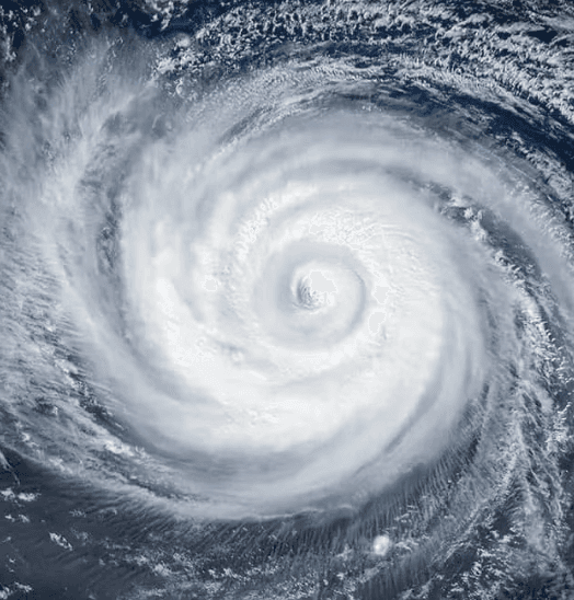
Super Typhoon Dolphin currently maintains Category 5-equivalent intensity with sustained winds near 145–160 mph over the open western Pacific near 20°N 158°E, according to Joint Typhoon Warning Center observations. Official forecast models show the system tracking west-northwest while encountering increasing wind shear and cooler waters, leading to rapid weakening to Category 2 or 1 strength by early next week. This trajectory places any potential approach to the Ogasawara Islands or Japanese mainland around August 6 at substantially reduced intensity well below Category 4 thresholds on the Saffir-Simpson scale. Recent model consensus and historical analogs during strong El Niño conditions support limited intensification potential near land, aligning with the 90% market-implied probability against a high-end landfall.
Polymarketデータを参照したAI生成の実験的な要約。これは取引アドバイスではなく、このマーケットの解決方法には一切関係ありません。 · 更新日スーパータイフーンドルフィンはカテゴリー4以上で上陸しますか?
スーパータイフーンドルフィンはカテゴリー4以上で上陸しますか?
はい
はい
The single JMA advisory in effect immediately prior to the observed crossing is authoritative for both position and intensity; no subsequent real-time advisory, reclassification, or post-season best-track reanalysis may retroactively change the outcome.
JMA position advisories are the primary resolution source. If a JMA advisory plots the center on land, the market resolves based on that advisory's wind speed. If no JMA advisory plots the center on land but credible reporting confirms a crossing occurred between discrete advisory fixes, the intensity is taken from the most recently issued JMA advisory prior to the confirmed crossing time.
This market resolves "No" if Dolphin makes landfall with the most recent prior JMA advisory showing maximum sustained winds below 105 knots, if Dolphin dissipates without making landfall on any territory, or if no landfall has physically occurred by the close of August 15, 2026.
マーケット開始日: Jul 30, 2026, 4:58 PM ET
Resolver
0x65070BE91...The single JMA advisory in effect immediately prior to the observed crossing is authoritative for both position and intensity; no subsequent real-time advisory, reclassification, or post-season best-track reanalysis may retroactively change the outcome.
JMA position advisories are the primary resolution source. If a JMA advisory plots the center on land, the market resolves based on that advisory's wind speed. If no JMA advisory plots the center on land but credible reporting confirms a crossing occurred between discrete advisory fixes, the intensity is taken from the most recently issued JMA advisory prior to the confirmed crossing time.
This market resolves "No" if Dolphin makes landfall with the most recent prior JMA advisory showing maximum sustained winds below 105 knots, if Dolphin dissipates without making landfall on any territory, or if no landfall has physically occurred by the close of August 15, 2026.
Resolver
0x65070BE91...Super Typhoon Dolphin currently maintains Category 5-equivalent intensity with sustained winds near 145–160 mph over the open western Pacific near 20°N 158°E, according to Joint Typhoon Warning Center observations. Official forecast models show the system tracking west-northwest while encountering increasing wind shear and cooler waters, leading to rapid weakening to Category 2 or 1 strength by early next week. This trajectory places any potential approach to the Ogasawara Islands or Japanese mainland around August 6 at substantially reduced intensity well below Category 4 thresholds on the Saffir-Simpson scale. Recent model consensus and historical analogs during strong El Niño conditions support limited intensification potential near land, aligning with the 90% market-implied probability against a high-end landfall.
Polymarketデータを参照したAI生成の実験的な要約。これは取引アドバイスではなく、このマーケットの解決方法には一切関係ありません。 · 更新日
外部リンクに注意してください。
外部リンクに注意してください。
よくある質問