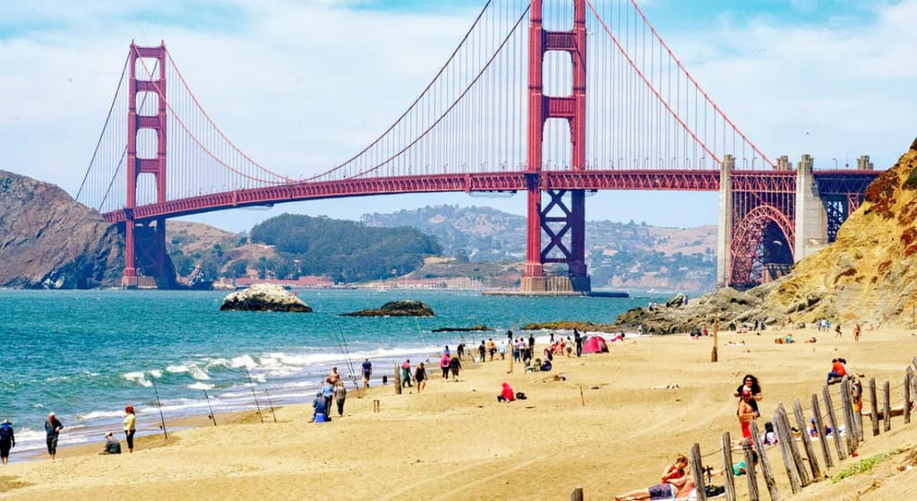
Persistent marine layer and moderate onshore flow from the Pacific are anchoring San Francisco’s August 17 high in the upper 60s to low 70s, aligning with National Weather Service point forecasts and model consensus that favor a peak near 69–71°F. Typical August climatology shows average highs of 67–70°F, with the cool sea breeze and morning stratus suppressing daytime heating even under a weak ridge. Recent model runs indicate limited warming potential, reinforcing trader consensus around the 70–71°F bracket. A stronger offshore component or rapid marine-layer erosion could allow readings into the mid-70s, but current conditions and afternoon forecast updates make such shifts unlikely before the daily maximum is recorded.
Ringkasan eksperimental yang dihasilkan AI dengan referensi data Polymarket. Ini bukan saran trading dan tidak berperan dalam bagaimana pasar ini diselesaikan. · DiperbaruiHighest temperature in San Francisco on August 17?
Highest temperature in San Francisco on August 17?
70-71°F 99.6%
72-73°F <1%
80°F or higher <1%
61°F or below <1%
$25,635 Vol.
$25,635 Vol.
Aug 17, 2026
61°F or below
<1%
62-63°F
<1%
64-65°F
<1%
66-67°F
<1%
68-69°F
<1%
70-71°F
100%
72-73°F
1%
74-75°F
<1%
76-77°F
<1%
78-79°F
<1%
80°F or higher
<1%
70-71°F 99.6%
72-73°F <1%
80°F or higher <1%
61°F or below <1%
$25,635 Vol.
$25,635 Vol.
Aug 17, 2026
61°F or below
$1,364 Vol.
<1%
62-63°F
$775 Vol.
<1%
64-65°F
$1,054 Vol.
<1%
66-67°F
$2,215 Vol.
<1%
68-69°F
$3,645 Vol.
<1%
70-71°F
$4,534 Vol.
100%
72-73°F
$5,074 Vol.
1%
74-75°F
$2,864 Vol.
<1%
76-77°F
$1,529 Vol.
<1%
78-79°F
$1,189 Vol.
<1%
80°F or higher
$1,392 Vol.
<1%
This market will resolve based on the highest temperature recorded in the 'Daily Observations' table on Weather Underground, not the figure displayed in the 'Day High & Low' summary section; in the event of any discrepancy between the two, the Daily Observations table shall be the primary resolution source not the Day High & Low section.
This market will resolve to the temperature range that contains the highest temperature recorded at the San Francisco International Airport Station in degrees Fahrenheit on 17 Aug '26.
The resolution source for this market will be information from Wunderground, specifically the highest temperature recorded for all times on this day for the San Francisco International Airport Station, available here: https://www.wunderground.com/history/daily/us/ca/san-francisco/KSFO.
To toggle between Fahrenheit and Celsius, click the gear icon next to the search bar and switch the Temperature setting between °F and °C.
This market can not resolve until the first data point for the following date has been published on the resolution source.
The resolution source for this market measures temperatures to whole degrees Fahrenheit (eg, 21°F). Thus, this is the level of precision that will be used when resolving the market.
Revisions to temperatures recorded within this market's timeframe will be considered until the first datapoint for the following date has been published, after which any alterations will not be considered.Persistent marine layer and moderate onshore flow from the Pacific are anchoring San Francisco’s August 17 high in the upper 60s to low 70s, aligning with National Weather Service point forecasts and model consensus that favor a peak near 69–71°F. Typical August climatology shows average highs of 67–70°F, with the cool sea breeze and morning stratus suppressing daytime heating even under a weak ridge. Recent model runs indicate limited warming potential, reinforcing trader consensus around the 70–71°F bracket. A stronger offshore component or rapid marine-layer erosion could allow readings into the mid-70s, but current conditions and afternoon forecast updates make such shifts unlikely before the daily maximum is recorded.
This market will resolve based on the highest temperature recorded in the 'Daily Observations' table on Weather Underground, not the figure displayed in the 'Day High & Low' summary section; in the event of any discrepancy between the two, the Daily Observations table shall be the primary resolution source not the Day High & Low section.
This market will resolve to the temperature range that contains the highest temperature recorded at the San Francisco International Airport Station in degrees Fahrenheit on 17 Aug '26.
The resolution source for this market will be information from Wunderground, specifically the highest temperature recorded for all times on this day for the San Francisco International Airport Station, available here: https://www.wunderground.com/history/daily/us/ca/san-francisco/KSFO.
To toggle between Fahrenheit and Celsius, click the gear icon next to the search bar and switch the Temperature setting between °F and °C.
This market can not resolve until the first data point for the following date has been published on the resolution source.
The resolution source for this market measures temperatures to whole degrees Fahrenheit (eg, 21°F). Thus, this is the level of precision that will be used when resolving the market.
Revisions to temperatures recorded within this market's timeframe will be considered until the first datapoint for the following date has been published, after which any alterations will not be considered.
This market will resolve to the temperature range that contains the highest temperature recorded at the San Francisco International Airport Station in degrees Fahrenheit on 17 Aug '26.
The resolution source for this market will be information from Wunderground, specifically the highest temperature recorded for all times on this day for the San Francisco International Airport Station, available here: https://www.wunderground.com/history/daily/us/ca/san-francisco/KSFO.
To toggle between Fahrenheit and Celsius, click the gear icon next to the search bar and switch the Temperature setting between °F and °C.
This market can not resolve until the first data point for the following date has been published on the resolution source.
The resolution source for this market measures temperatures to whole degrees Fahrenheit (eg, 21°F). Thus, this is the level of precision that will be used when resolving the market.
Revisions to temperatures recorded within this market's timeframe will be considered until the first datapoint for the following date has been published, after which any alterations will not be considered.
Pasar Dibuka: Aug 15, 2026, 9:57 PM ET
Volume
$25,635Tanggal Berakhir
Aug 17, 2026Pasar Dibuka
Aug 15, 2026, 9:57 PM ETResolver
0x69c47De9D...This market will resolve based on the highest temperature recorded in the 'Daily Observations' table on Weather Underground, not the figure displayed in the 'Day High & Low' summary section; in the event of any discrepancy between the two, the Daily Observations table shall be the primary resolution source not the Day High & Low section.
This market will resolve to the temperature range that contains the highest temperature recorded at the San Francisco International Airport Station in degrees Fahrenheit on 17 Aug '26.
The resolution source for this market will be information from Wunderground, specifically the highest temperature recorded for all times on this day for the San Francisco International Airport Station, available here: https://www.wunderground.com/history/daily/us/ca/san-francisco/KSFO.
To toggle between Fahrenheit and Celsius, click the gear icon next to the search bar and switch the Temperature setting between °F and °C.
This market can not resolve until the first data point for the following date has been published on the resolution source.
The resolution source for this market measures temperatures to whole degrees Fahrenheit (eg, 21°F). Thus, this is the level of precision that will be used when resolving the market.
Revisions to temperatures recorded within this market's timeframe will be considered until the first datapoint for the following date has been published, after which any alterations will not be considered.Persistent marine layer and moderate onshore flow from the Pacific are anchoring San Francisco’s August 17 high in the upper 60s to low 70s, aligning with National Weather Service point forecasts and model consensus that favor a peak near 69–71°F. Typical August climatology shows average highs of 67–70°F, with the cool sea breeze and morning stratus suppressing daytime heating even under a weak ridge. Recent model runs indicate limited warming potential, reinforcing trader consensus around the 70–71°F bracket. A stronger offshore component or rapid marine-layer erosion could allow readings into the mid-70s, but current conditions and afternoon forecast updates make such shifts unlikely before the daily maximum is recorded.
This market will resolve based on the highest temperature recorded in the 'Daily Observations' table on Weather Underground, not the figure displayed in the 'Day High & Low' summary section; in the event of any discrepancy between the two, the Daily Observations table shall be the primary resolution source not the Day High & Low section.
This market will resolve to the temperature range that contains the highest temperature recorded at the San Francisco International Airport Station in degrees Fahrenheit on 17 Aug '26.
The resolution source for this market will be information from Wunderground, specifically the highest temperature recorded for all times on this day for the San Francisco International Airport Station, available here: https://www.wunderground.com/history/daily/us/ca/san-francisco/KSFO.
To toggle between Fahrenheit and Celsius, click the gear icon next to the search bar and switch the Temperature setting between °F and °C.
This market can not resolve until the first data point for the following date has been published on the resolution source.
The resolution source for this market measures temperatures to whole degrees Fahrenheit (eg, 21°F). Thus, this is the level of precision that will be used when resolving the market.
Revisions to temperatures recorded within this market's timeframe will be considered until the first datapoint for the following date has been published, after which any alterations will not be considered.
This market will resolve to the temperature range that contains the highest temperature recorded at the San Francisco International Airport Station in degrees Fahrenheit on 17 Aug '26.
The resolution source for this market will be information from Wunderground, specifically the highest temperature recorded for all times on this day for the San Francisco International Airport Station, available here: https://www.wunderground.com/history/daily/us/ca/san-francisco/KSFO.
To toggle between Fahrenheit and Celsius, click the gear icon next to the search bar and switch the Temperature setting between °F and °C.
This market can not resolve until the first data point for the following date has been published on the resolution source.
The resolution source for this market measures temperatures to whole degrees Fahrenheit (eg, 21°F). Thus, this is the level of precision that will be used when resolving the market.
Revisions to temperatures recorded within this market's timeframe will be considered until the first datapoint for the following date has been published, after which any alterations will not be considered.
Volume
$25,635Tanggal Berakhir
Aug 17, 2026Pasar Dibuka
Aug 15, 2026, 9:57 PM ETResolver
0x69c47De9D...Persistent marine layer and moderate onshore flow from the Pacific are anchoring San Francisco’s August 17 high in the upper 60s to low 70s, aligning with National Weather Service point forecasts and model consensus that favor a peak near 69–71°F. Typical August climatology shows average highs of 67–70°F, with the cool sea breeze and morning stratus suppressing daytime heating even under a weak ridge. Recent model runs indicate limited warming potential, reinforcing trader consensus around the 70–71°F bracket. A stronger offshore component or rapid marine-layer erosion could allow readings into the mid-70s, but current conditions and afternoon forecast updates make such shifts unlikely before the daily maximum is recorded.
Ringkasan eksperimental yang dihasilkan AI dengan referensi data Polymarket. Ini bukan saran trading dan tidak berperan dalam bagaimana pasar ini diselesaikan. · Diperbarui

Hati-hati dengan link eksternal.
Hati-hati dengan link eksternal.
Pertanyaan yang Sering Diajukan