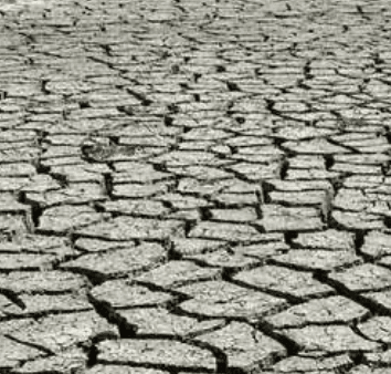
Recent expansion of D3–D4 conditions across the Southern and Central Plains, driven by persistent high-pressure systems and above-normal temperatures, represents the dominant factor shaping trader views on states reaching exceptional drought (D4) status for the week of August 25. The U.S. Drought Monitor map released August 20, valid through August 18, shows D4 covering 1.1% of the contiguous United States, concentrated in western and south-central regions, with the Northwest also deteriorating while parts of the East and Interior West saw localized improvement from recent rains. The next weekly update, expected around August 27 and reflecting conditions through late August, will incorporate the latest precipitation, soil moisture, and streamflow data from NOAA and USDA networks; any further degradation or relief from monsoon activity or frontal systems could shift the number of affected states.
Résumé expérimental généré par IA à partir des données Polymarket. Ceci n'est pas un conseil de trading et ne joue aucun rôle dans la résolution de ce marché. · Mis à jourExceptional drought (D4) by state — week of August 25, 2026
Exceptional drought (D4) by state — week of August 25, 2026
Alabama
50%
Arizona
50%
Arkansas
50%
California
50%
Colorado
50%
Delaware
50%
Florida
50%
Georgia
50%
Idaho
50%
Illinois
50%
Indiana
50%
Iowa
50%
Kansas
50%
Kentucky
50%
Louisiana
50%
Maryland
50%
Minnesota
50%
Mississippi
50%
Missouri
50%
Montana
50%
Nebraska
79%
Nevada
50%
New Jersey
50%
New Mexico
52%
North Carolina
51%
North Dakota
50%
Ohio
50%
Oklahoma
50%
Oregon
50%
Pennsylvania
50%
South Carolina
50%
South Dakota
50%
Tennessee
50%
Texas
50%
Utah
50%
Virginia
50%
Washington
50%
West Virginia
50%
Wisconsin
50%
Wyoming
51%
$1,395 Vol.
Alabama
50%
Arizona
50%
Arkansas
50%
California
50%
Colorado
50%
Delaware
50%
Florida
50%
Georgia
50%
Idaho
50%
Illinois
50%
Indiana
50%
Iowa
50%
Kansas
50%
Kentucky
50%
Louisiana
50%
Maryland
50%
Minnesota
50%
Mississippi
50%
Missouri
50%
Montana
50%
Nebraska
79%
Nevada
50%
New Jersey
50%
New Mexico
52%
North Carolina
51%
North Dakota
50%
Ohio
50%
Oklahoma
50%
Oregon
50%
Pennsylvania
50%
South Carolina
50%
South Dakota
50%
Tennessee
50%
Texas
50%
Utah
50%
Virginia
50%
Washington
50%
West Virginia
50%
Wisconsin
50%
Wyoming
51%
D4 area below 0.05% is treated as cartographic noise at state borders and resolves "No".
Alabama carries a market in May through November, so this market exists for the week valid August 25, 2026. Weeks outside that window have no Alabama market and make no claim about Alabama's drought.
Each USDM release covers the seven-day period ending Tuesday at 8:00 AM ET and is published the following Thursday.
Resolution is based on the first published US Drought Monitor release for the listed week. Subsequent revisions will not be considered; the first published release is final.
The resolution source for this market is the US Drought Monitor at droughtmonitor.unl.edu.
Marché ouvert : Aug 20, 2026, 9:00 AM ET
Source de résolution
https://droughtmonitor.unl.edu/DmData/DataTables.aspxResolver
0x65070BE91...D4 area below 0.05% is treated as cartographic noise at state borders and resolves "No".
Alabama carries a market in May through November, so this market exists for the week valid August 25, 2026. Weeks outside that window have no Alabama market and make no claim about Alabama's drought.
Each USDM release covers the seven-day period ending Tuesday at 8:00 AM ET and is published the following Thursday.
Resolution is based on the first published US Drought Monitor release for the listed week. Subsequent revisions will not be considered; the first published release is final.
The resolution source for this market is the US Drought Monitor at droughtmonitor.unl.edu.
Source de résolution
https://droughtmonitor.unl.edu/DmData/DataTables.aspxResolver
0x65070BE91...Recent expansion of D3–D4 conditions across the Southern and Central Plains, driven by persistent high-pressure systems and above-normal temperatures, represents the dominant factor shaping trader views on states reaching exceptional drought (D4) status for the week of August 25. The U.S. Drought Monitor map released August 20, valid through August 18, shows D4 covering 1.1% of the contiguous United States, concentrated in western and south-central regions, with the Northwest also deteriorating while parts of the East and Interior West saw localized improvement from recent rains. The next weekly update, expected around August 27 and reflecting conditions through late August, will incorporate the latest precipitation, soil moisture, and streamflow data from NOAA and USDA networks; any further degradation or relief from monsoon activity or frontal systems could shift the number of affected states.
Résumé expérimental généré par IA à partir des données Polymarket. Ceci n'est pas un conseil de trading et ne joue aucun rôle dans la résolution de ce marché. · Mis à jour
Méfiez-vous des liens externes.
Méfiez-vous des liens externes.
Questions fréquentes