
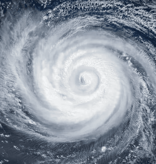
Recent Joint Typhoon Warning Center and model consensus show Super Typhoon Dolphin weakening after peaking near Category 5 intensity, with sustained winds now around 125–145 mph and further decline expected over the next several days. Environmental factors including increasing wind shear, cooler sea-surface temperatures, and a gradual westward turn toward the Ryukyu Islands or East China Sea are projected to reduce the system to Category 1–2 strength before any potential landfall window in early August. Official forecasts indicate no scenario of Category 4+ intensity at landfall, consistent with historical analogs for storms recurving at similar latitudes during developing El Niño conditions. Updated JTWC guidance and ensemble runs through the coming week will refine the track and intensity trends.
สรุปจาก AI ทดลองที่อ้างอิงข้อมูลจาก Polymarket ไม่ใช่คำแนะนำในการเทรดและไม่มีผลต่อการตัดสินตลาดนี้ · อัปเดตแล้วWill Super Typhoon Dolphin make landfall at Category 4 strength or higher?
Will Super Typhoon Dolphin make landfall at Category 4 strength or higher?
The single JMA advisory in effect immediately prior to the observed crossing is authoritative for both position and intensity; no subsequent real-time advisory, reclassification, or post-season best-track reanalysis may retroactively change the outcome.
JMA position advisories are the primary resolution source. If a JMA advisory plots the center on land, the market resolves based on that advisory's wind speed. If no JMA advisory plots the center on land but credible reporting confirms a crossing occurred between discrete advisory fixes, the intensity is taken from the most recently issued JMA advisory prior to the confirmed crossing time.
This market resolves "No" if Dolphin makes landfall with the most recent prior JMA advisory showing maximum sustained winds below 105 knots, if Dolphin dissipates without making landfall on any territory, or if no landfall has physically occurred by the close of August 15, 2026.
ตลาดเปิดเมื่อ: Jul 30, 2026, 4:58 PM ET
Resolver
0x65070BE91...The single JMA advisory in effect immediately prior to the observed crossing is authoritative for both position and intensity; no subsequent real-time advisory, reclassification, or post-season best-track reanalysis may retroactively change the outcome.
JMA position advisories are the primary resolution source. If a JMA advisory plots the center on land, the market resolves based on that advisory's wind speed. If no JMA advisory plots the center on land but credible reporting confirms a crossing occurred between discrete advisory fixes, the intensity is taken from the most recently issued JMA advisory prior to the confirmed crossing time.
This market resolves "No" if Dolphin makes landfall with the most recent prior JMA advisory showing maximum sustained winds below 105 knots, if Dolphin dissipates without making landfall on any territory, or if no landfall has physically occurred by the close of August 15, 2026.
Resolver
0x65070BE91...Recent Joint Typhoon Warning Center and model consensus show Super Typhoon Dolphin weakening after peaking near Category 5 intensity, with sustained winds now around 125–145 mph and further decline expected over the next several days. Environmental factors including increasing wind shear, cooler sea-surface temperatures, and a gradual westward turn toward the Ryukyu Islands or East China Sea are projected to reduce the system to Category 1–2 strength before any potential landfall window in early August. Official forecasts indicate no scenario of Category 4+ intensity at landfall, consistent with historical analogs for storms recurving at similar latitudes during developing El Niño conditions. Updated JTWC guidance and ensemble runs through the coming week will refine the track and intensity trends.
สรุปจาก AI ทดลองที่อ้างอิงข้อมูลจาก Polymarket ไม่ใช่คำแนะนำในการเทรดและไม่มีผลต่อการตัดสินตลาดนี้ · อัปเดตแล้ว
ระวังลิงก์ภายนอก
ระวังลิงก์ภายนอก
คำถามที่พบบ่อย