
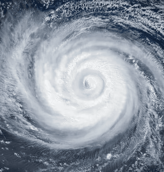
Super Typhoon Dolphin, currently a Category 5 system with maximum sustained winds near 160–165 mph far east in the northwest Pacific at roughly 20°N 158°E, shows no immediate landfall threat according to Joint Typhoon Warning Center guidance. Primary drivers for the 90% market-implied probability on “No” include its expected slow weakening trend from increasing wind shear and cooler waters over the next several days, combined with forecast tracks keeping the core well south of Japan and the Ryukyu Islands before any possible East China Sea approach as a Category 1–2 storm. Model consensus from HAFS, HWRF, and DeepMind runs supports steady intensity loss, limiting the chance of Category 4+ winds reaching land. Upcoming JTWC updates and new model runs will refine the track and intensity outlook through early August.
Eksperymentalne podsumowanie AI odwołujące się do danych Polymarket. To nie jest porada handlowa i nie ma wpływu na rozstrzyganie tego rynku. · ZaktualizowanoWill Super Typhoon Dolphin make landfall at Category 4 strength or higher?
Will Super Typhoon Dolphin make landfall at Category 4 strength or higher?
The single JMA advisory in effect immediately prior to the observed crossing is authoritative for both position and intensity; no subsequent real-time advisory, reclassification, or post-season best-track reanalysis may retroactively change the outcome.
JMA position advisories are the primary resolution source. If a JMA advisory plots the center on land, the market resolves based on that advisory's wind speed. If no JMA advisory plots the center on land but credible reporting confirms a crossing occurred between discrete advisory fixes, the intensity is taken from the most recently issued JMA advisory prior to the confirmed crossing time.
This market resolves "No" if Dolphin makes landfall with the most recent prior JMA advisory showing maximum sustained winds below 105 knots, if Dolphin dissipates without making landfall on any territory, or if no landfall has physically occurred by the close of August 15, 2026.
Rynek otwarty: Jul 30, 2026, 4:58 PM ET
Resolver
0x65070BE91...The single JMA advisory in effect immediately prior to the observed crossing is authoritative for both position and intensity; no subsequent real-time advisory, reclassification, or post-season best-track reanalysis may retroactively change the outcome.
JMA position advisories are the primary resolution source. If a JMA advisory plots the center on land, the market resolves based on that advisory's wind speed. If no JMA advisory plots the center on land but credible reporting confirms a crossing occurred between discrete advisory fixes, the intensity is taken from the most recently issued JMA advisory prior to the confirmed crossing time.
This market resolves "No" if Dolphin makes landfall with the most recent prior JMA advisory showing maximum sustained winds below 105 knots, if Dolphin dissipates without making landfall on any territory, or if no landfall has physically occurred by the close of August 15, 2026.
Resolver
0x65070BE91...Super Typhoon Dolphin, currently a Category 5 system with maximum sustained winds near 160–165 mph far east in the northwest Pacific at roughly 20°N 158°E, shows no immediate landfall threat according to Joint Typhoon Warning Center guidance. Primary drivers for the 90% market-implied probability on “No” include its expected slow weakening trend from increasing wind shear and cooler waters over the next several days, combined with forecast tracks keeping the core well south of Japan and the Ryukyu Islands before any possible East China Sea approach as a Category 1–2 storm. Model consensus from HAFS, HWRF, and DeepMind runs supports steady intensity loss, limiting the chance of Category 4+ winds reaching land. Upcoming JTWC updates and new model runs will refine the track and intensity outlook through early August.
Eksperymentalne podsumowanie AI odwołujące się do danych Polymarket. To nie jest porada handlowa i nie ma wpływu na rozstrzyganie tego rynku. · Zaktualizowano
Uważaj na linki zewnętrzne.
Uważaj na linki zewnętrzne.
Często zadawane pytania