
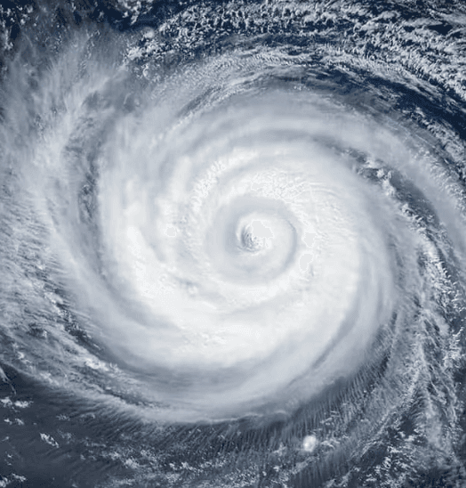
Recent JTWC analyses show Super Typhoon Dolphin, currently a Category 4–5 system with 1-minute sustained winds near 240 km/h, undergoing an eyewall replacement cycle that has already prompted slight weakening while maintaining violent typhoon status per JMA. Forecast models project further intensity loss from land interaction, increasing shear, or cooler waters before any potential western Pacific or Japan landfall, making Category 4+ arrival at the coast unlikely. Warm sea-surface temperatures support short-term maintenance, yet steering patterns and historical analogs for similar recurving tracks favor rapid decay near land. These dynamics underpin the 90% market-implied probability traders assign to “No,” with resolution hinging on official intensity thresholds at the moment of landfall.
Eksperimental na AI-generated summary na nire-reference ang Polymarket data. Hindi ito trading advice at wala itong papel sa kung paano nire-resolve ang market na ito. · Na-updateWill Super Typhoon Dolphin make landfall at Category 4 strength or higher?
Will Super Typhoon Dolphin make landfall at Category 4 strength or higher?
The single JMA advisory in effect immediately prior to the observed crossing is authoritative for both position and intensity; no subsequent real-time advisory, reclassification, or post-season best-track reanalysis may retroactively change the outcome.
JMA position advisories are the primary resolution source. If a JMA advisory plots the center on land, the market resolves based on that advisory's wind speed. If no JMA advisory plots the center on land but credible reporting confirms a crossing occurred between discrete advisory fixes, the intensity is taken from the most recently issued JMA advisory prior to the confirmed crossing time.
This market resolves "No" if Dolphin makes landfall with the most recent prior JMA advisory showing maximum sustained winds below 105 knots, if Dolphin dissipates without making landfall on any territory, or if no landfall has physically occurred by the close of August 15, 2026.
Binuksan ang Market: Jul 30, 2026, 4:58 PM ET
Resolver
0x65070BE91...The single JMA advisory in effect immediately prior to the observed crossing is authoritative for both position and intensity; no subsequent real-time advisory, reclassification, or post-season best-track reanalysis may retroactively change the outcome.
JMA position advisories are the primary resolution source. If a JMA advisory plots the center on land, the market resolves based on that advisory's wind speed. If no JMA advisory plots the center on land but credible reporting confirms a crossing occurred between discrete advisory fixes, the intensity is taken from the most recently issued JMA advisory prior to the confirmed crossing time.
This market resolves "No" if Dolphin makes landfall with the most recent prior JMA advisory showing maximum sustained winds below 105 knots, if Dolphin dissipates without making landfall on any territory, or if no landfall has physically occurred by the close of August 15, 2026.
Resolver
0x65070BE91...Recent JTWC analyses show Super Typhoon Dolphin, currently a Category 4–5 system with 1-minute sustained winds near 240 km/h, undergoing an eyewall replacement cycle that has already prompted slight weakening while maintaining violent typhoon status per JMA. Forecast models project further intensity loss from land interaction, increasing shear, or cooler waters before any potential western Pacific or Japan landfall, making Category 4+ arrival at the coast unlikely. Warm sea-surface temperatures support short-term maintenance, yet steering patterns and historical analogs for similar recurving tracks favor rapid decay near land. These dynamics underpin the 90% market-implied probability traders assign to “No,” with resolution hinging on official intensity thresholds at the moment of landfall.
Eksperimental na AI-generated summary na nire-reference ang Polymarket data. Hindi ito trading advice at wala itong papel sa kung paano nire-resolve ang market na ito. · Na-update
Mag-ingat sa mga external link.
Mag-ingat sa mga external link.
Mga Madalas na Tanong