
Recent official forecasts from PAGASA and JMA indicate Typhoon Saudel has rapidly intensified to sustained winds near 110-125 knots over the western Pacific, with warm sea surface temperatures, low vertical wind shear, and robust convective structure supporting further strengthening into super typhoon range before or upon entering the Philippine Area of Responsibility on August 24. Model consensus points to a short-lived peak near or above 90-105 knots before increased shear, cooler waters, and an eyewall replacement cycle initiate weakening. This environment and current intensity trajectory align with trader emphasis on Very Strong Typhoon as the most probable peak category, while limiting odds for Violent Typhoon or lower outcomes given the narrow window for additional intensification.
Resumo experimental gerado por IA com dados do Polymarket. Isto não é aconselhamento de trading e não tem qualquer papel na resolução deste mercado. · AtualizadoQuão forte será a tempestade tropical Saudel?
Quão forte será a tempestade tropical Saudel?
Tufão Muito Forte 86%
Tufão Violento 14%
Tufão 1.3%
Tempestade Tropical <1%
Tempestade Tropical
<1%
Tempestade Tropical Severa
<1%
Tufão
1%
Tufão Muito Forte
86%
Tufão Violento
14%
Tufão Muito Forte 86%
Tufão Violento 14%
Tufão 1.3%
Tempestade Tropical <1%
Tempestade Tropical
<1%
Tempestade Tropical Severa
<1%
Tufão
1%
Tufão Muito Forte
86%
Tufão Violento
14%
Resolution is by wind speed: take the highest 10-minute maximum sustained wind speed JMA reports for Saudel in any single advisory during its lifetime, and the market for the one category whose range contains that value resolves "Yes." The categories are defined solely by these inclusive knot ranges: Tropical Storm (34-47 kt), Severe Tropical Storm (48-63 kt), Typhoon (64-84 kt), Very Strong Typhoon (85-104 kt), and Violent Typhoon (105 kt or higher). These names label the wind-speed ranges; JMA's own strength wording need not appear in an advisory for a category to resolve. The peak must occur on or before the deadline, though the confirming JMA data may be published later.
Saudel is already a tropical storm, so its peak is at least "Tropical Storm". The wind speed in JMA's issued advisories is final and is not changed by any later reclassification or post-season best-track reanalysis. Where JMA advisory data is disputed, the values recorded by the Digital Typhoon database (National Institute of Informatics, Japan) for Typhoon 202618 (SAUDEL) are treated as conclusive evidence of what JMA reported. JMA is the primary and default resolution source.
Mercado Aberto: Aug 20, 2026, 11:11 AM ET
Fonte de resolução
https://www.jma.go.jp/bosai/map.html#contents=typhoon&lang=enResolver
0x69c47De9D...Resolution is by wind speed: take the highest 10-minute maximum sustained wind speed JMA reports for Saudel in any single advisory during its lifetime, and the market for the one category whose range contains that value resolves "Yes." The categories are defined solely by these inclusive knot ranges: Tropical Storm (34-47 kt), Severe Tropical Storm (48-63 kt), Typhoon (64-84 kt), Very Strong Typhoon (85-104 kt), and Violent Typhoon (105 kt or higher). These names label the wind-speed ranges; JMA's own strength wording need not appear in an advisory for a category to resolve. The peak must occur on or before the deadline, though the confirming JMA data may be published later.
Saudel is already a tropical storm, so its peak is at least "Tropical Storm". The wind speed in JMA's issued advisories is final and is not changed by any later reclassification or post-season best-track reanalysis. Where JMA advisory data is disputed, the values recorded by the Digital Typhoon database (National Institute of Informatics, Japan) for Typhoon 202618 (SAUDEL) are treated as conclusive evidence of what JMA reported. JMA is the primary and default resolution source.
Fonte de resolução
https://www.jma.go.jp/bosai/map.html#contents=typhoon&lang=enResolver
0x69c47De9D...Recent official forecasts from PAGASA and JMA indicate Typhoon Saudel has rapidly intensified to sustained winds near 110-125 knots over the western Pacific, with warm sea surface temperatures, low vertical wind shear, and robust convective structure supporting further strengthening into super typhoon range before or upon entering the Philippine Area of Responsibility on August 24. Model consensus points to a short-lived peak near or above 90-105 knots before increased shear, cooler waters, and an eyewall replacement cycle initiate weakening. This environment and current intensity trajectory align with trader emphasis on Very Strong Typhoon as the most probable peak category, while limiting odds for Violent Typhoon or lower outcomes given the narrow window for additional intensification.
Resumo experimental gerado por IA com dados do Polymarket. Isto não é aconselhamento de trading e não tem qualquer papel na resolução deste mercado. · Atualizado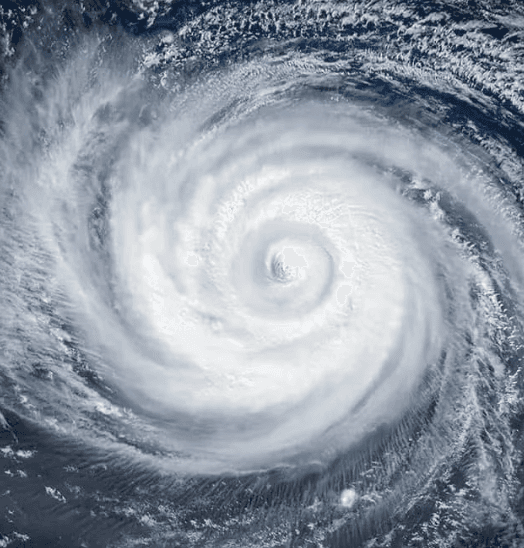

Cuidado com os links externos.
Cuidado com os links externos.
Frequently Asked Questions