
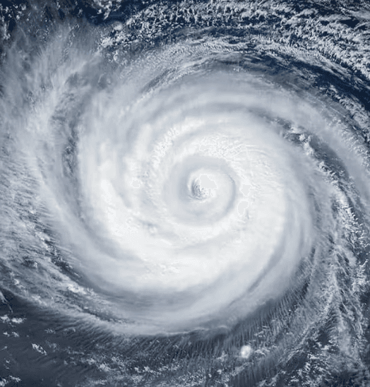
**Recent weakening of Typhoon Dolphin after its late-July peak as a Category 5-equivalent super typhoon drives the near-certain market consensus against Category 4+ landfall.** Official JTWC analyses show the system has dropped to roughly 75–85 mph sustained winds (Category 1 or tropical storm strength) while tracking west-northwest across the East China Sea, with current position about 340 km northeast of Taipei as of early August 9, 2026. Environmental factors including cooler sea-surface temperatures, increasing wind shear, and proximity to land have curtailed the earlier rapid intensification fueled by warm waters and low shear. Multi-model consensus and JTWC guidance indicate continued weakening or minimal change ahead of expected landfall over eastern China south of Shanghai within 12–24 hours. While forecast adjustments remain possible with new satellite or model runs, the storm’s current intensity and trajectory make a Category 4+ (130+ mph) landfall highly improbable before dissipation.
Polymarket ডেটা রেফারেন্স করে পরীক্ষামূলক AI-জেনারেটেড সারাংশ। এটি ট্রেডিং পরামর্শ নয় এবং এই মার্কেট কীভাবে রেজলভ হয় তাতে কোনো ভূমিকা রাখে না। · আপডেটেডWill Super Typhoon Dolphin make landfall at Category 4 strength or higher?
Will Super Typhoon Dolphin make landfall at Category 4 strength or higher?
$16,862 Vol.
$16,862 Vol.
$16,862 Vol.
$16,862 Vol.
The single JMA advisory in effect immediately prior to the observed crossing is authoritative for both position and intensity; no subsequent real-time advisory, reclassification, or post-season best-track reanalysis may retroactively change the outcome.
JMA position advisories are the primary resolution source. If a JMA advisory plots the center on land, the market resolves based on that advisory's wind speed. If no JMA advisory plots the center on land but credible reporting confirms a crossing occurred between discrete advisory fixes, the intensity is taken from the most recently issued JMA advisory prior to the confirmed crossing time.
This market resolves "No" if Dolphin makes landfall with the most recent prior JMA advisory showing maximum sustained winds below 105 knots, if Dolphin dissipates without making landfall on any territory, or if no landfall has physically occurred by the close of August 15, 2026.
মার্কেট ওপেন হয়েছে: Jul 30, 2026, 4:58 PM ET
Resolver
0x65070BE91...The single JMA advisory in effect immediately prior to the observed crossing is authoritative for both position and intensity; no subsequent real-time advisory, reclassification, or post-season best-track reanalysis may retroactively change the outcome.
JMA position advisories are the primary resolution source. If a JMA advisory plots the center on land, the market resolves based on that advisory's wind speed. If no JMA advisory plots the center on land but credible reporting confirms a crossing occurred between discrete advisory fixes, the intensity is taken from the most recently issued JMA advisory prior to the confirmed crossing time.
This market resolves "No" if Dolphin makes landfall with the most recent prior JMA advisory showing maximum sustained winds below 105 knots, if Dolphin dissipates without making landfall on any territory, or if no landfall has physically occurred by the close of August 15, 2026.
Resolver
0x65070BE91...**Recent weakening of Typhoon Dolphin after its late-July peak as a Category 5-equivalent super typhoon drives the near-certain market consensus against Category 4+ landfall.** Official JTWC analyses show the system has dropped to roughly 75–85 mph sustained winds (Category 1 or tropical storm strength) while tracking west-northwest across the East China Sea, with current position about 340 km northeast of Taipei as of early August 9, 2026. Environmental factors including cooler sea-surface temperatures, increasing wind shear, and proximity to land have curtailed the earlier rapid intensification fueled by warm waters and low shear. Multi-model consensus and JTWC guidance indicate continued weakening or minimal change ahead of expected landfall over eastern China south of Shanghai within 12–24 hours. While forecast adjustments remain possible with new satellite or model runs, the storm’s current intensity and trajectory make a Category 4+ (130+ mph) landfall highly improbable before dissipation.
Polymarket ডেটা রেফারেন্স করে পরীক্ষামূলক AI-জেনারেটেড সারাংশ। এটি ট্রেডিং পরামর্শ নয় এবং এই মার্কেট কীভাবে রেজলভ হয় তাতে কোনো ভূমিকা রাখে না। · আপডেটেড
বাহ্যিক লিংক থেকে সাবধান।
বাহ্যিক লিংক থেকে সাবধান।
সচরাচর জিজ্ঞাসা